MOGenWeb Project Links MOGenWeb Project Missouri County Identification Map Modern MOGenWeb Tombstone Transcription Project MOGenWeb Project Archives MOGenWeb Census Project USGenWeb Tombstone Transcription Project |
WELCOME! My name is Denise Woodside and I am the new county coordinator for the Ripley County MOGenweb page. We are transitioning to our new site on the MOGenWeb domain, so we will have several broken links until we get them fixed. Thanks for your patience, and don't hesitate to email if you have information that you would like to share.Ripley County, missouri MOGenWeb Ripley county was organized January 5,
1833, from Wayne County and is named for Eleazer W. Ripley,
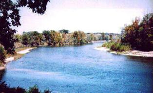
a soldier of the War of 1812. The Current River runs through the middle of the county. Like it's neighboring counties to the north, it is a popular resort area for fishing, float trips, and canoeing. Ripley County is rich in heritage and I am proud that my ancestors made Ripley County their home.
|
This site is part of the USGenWeb Project which is a volunteer genealogical organization dedicated to the free access of genealogical information.
USGenWeb Project Links
|
ABOUT RIPLEY COUNTY
Doniphan Missouri...
Historic Doniphan, MO was settled in 1819 near an Indian village
and French trading post.
Its historic district is centered
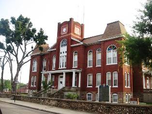
around the Ripley County Courthouse
and other buildings, all on
the National Register of Historic Places.
It is on the first
federal highway west of the Mississippi River,
and on the famous
Cherokee Trail of Tears.
Civil War sites are in every corner of
the county.
A downtown historical museum and gift shop displays
many artifacts and crafts.
Court House The City of Doniphan is located near
the center of Ripley County on the East bank of the Current
River.
Ripley County is located in the Ozark Foothills region of
Missouri near the Arkansas border.
The County is bordered by
Butler County to the East,
Carter County to the North and Oregon
County to the West.
To the South are the Arkansas counties of
Randolph and Clay.
Doniphan lies approximately 30 miles West of
Poplar Bluff, Missouri,
10 miles North of the Arkansas border,
180 miles East of Springfield, Missouri,
and 180 miles South of
St. Louis, Missouri.
U.S. Highway 160 runs East/West thru
Doniphan, as do two State Highways, 21 and 142.